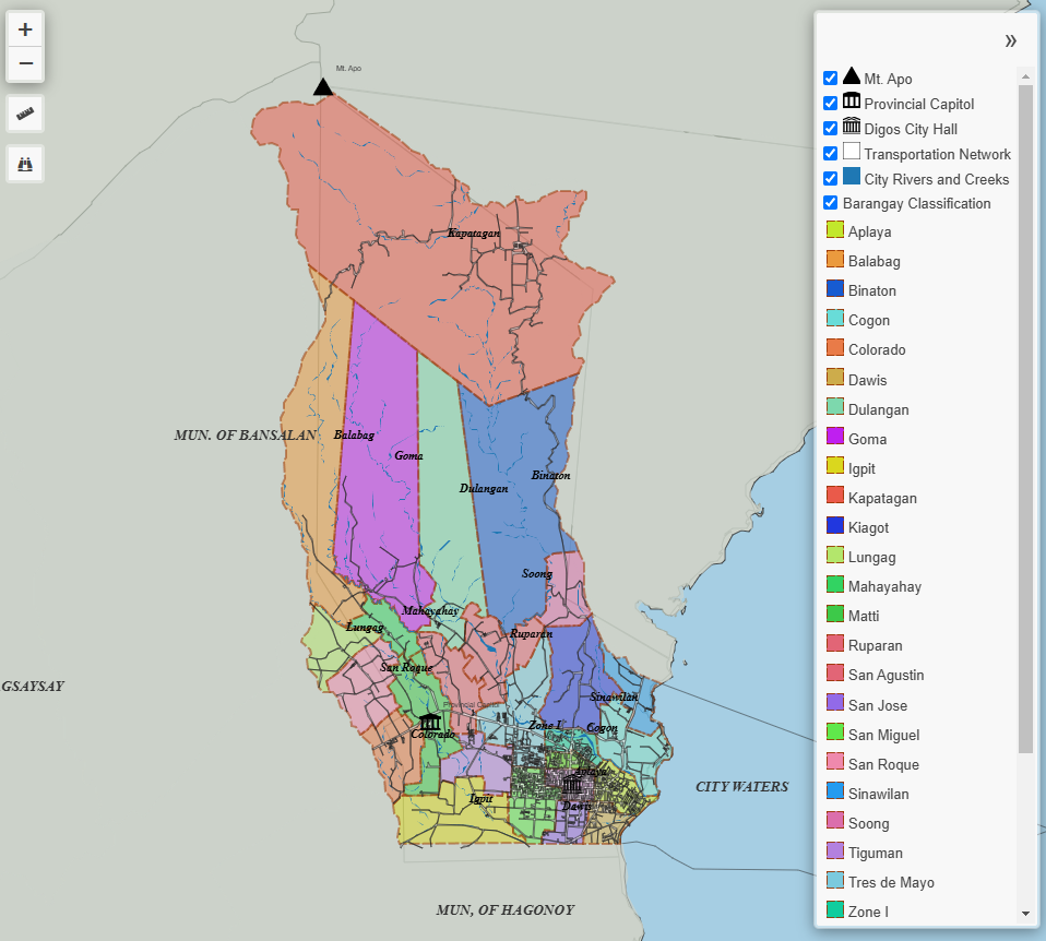
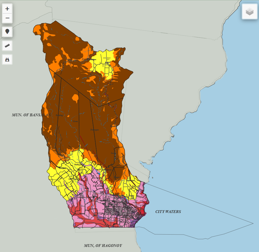
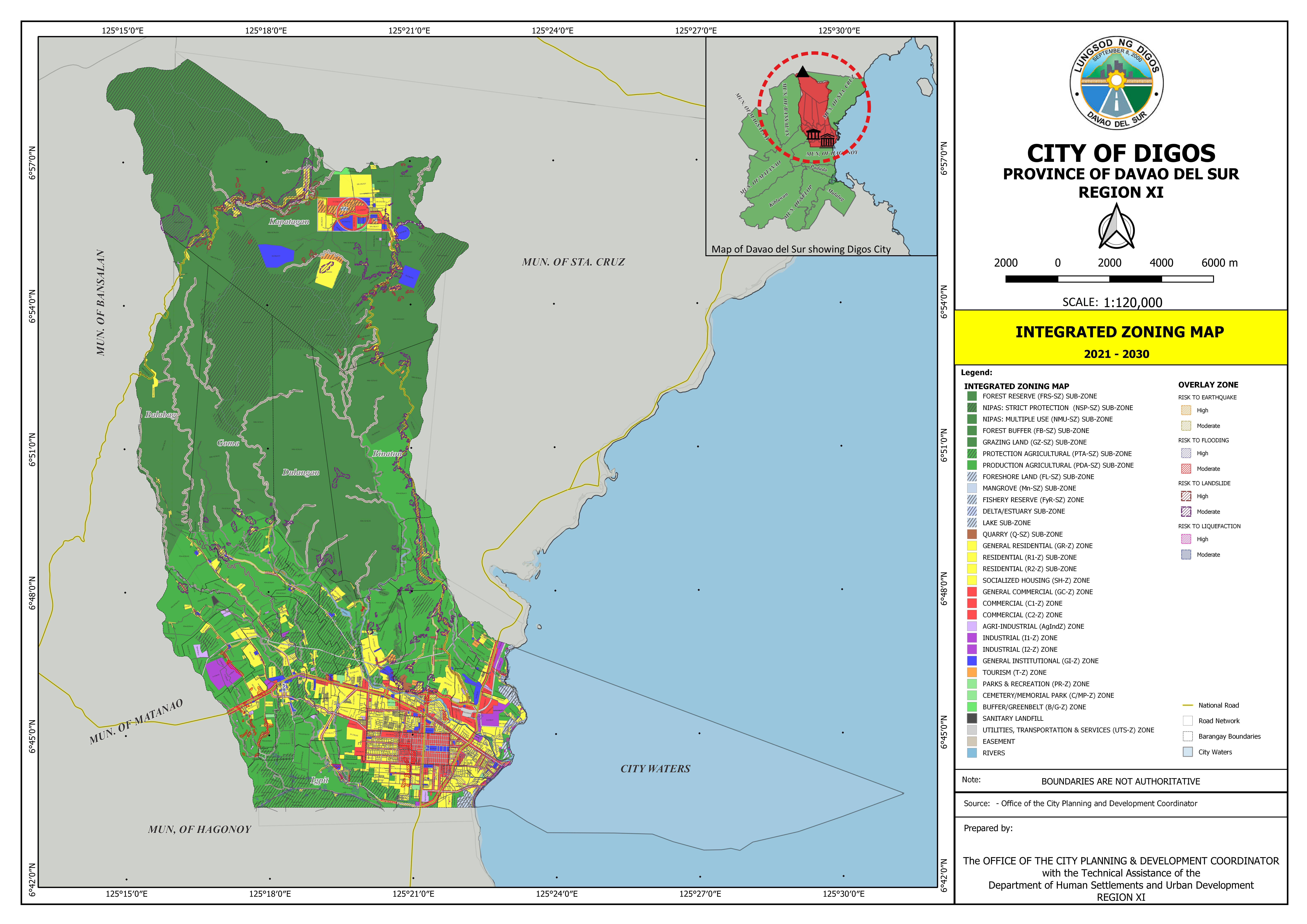
INTEGRATED ZONING MAP
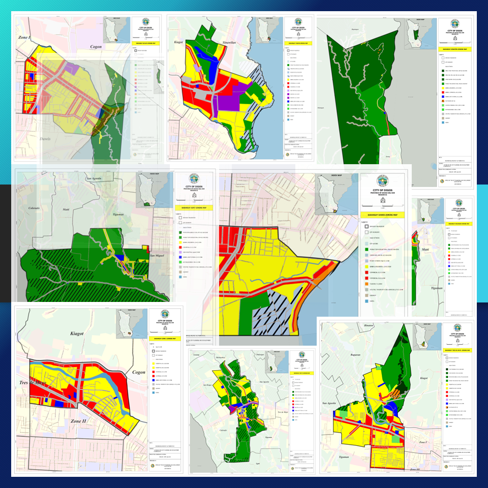
ZONING MAPS BY BARANGAY
Note: All information reflected on the maps shall be subject for verification from the City Planning Office.
Contact Us
Drop By
![]() 4F New City Hall Building, Jose Abad Santos Street, Digos City, Davao del Sur 8002
4F New City Hall Building, Jose Abad Santos Street, Digos City, Davao del Sur 8002
